INES (INtegrated assessment and mapping of water-related Ecosystem Services for nature-based solutions in river basin management) is a three years fundamental research project funded by the Bulgarian National Science Fund. The project aims to develop a methodological framework for mapping, modeling, and assessment of water-related ecosystem services (WRES) in respect to the implementation of nature-based solutions in water management. The project is led by Stoyan Nedkov – professor at the National Institute of Geophysics, Geodesy and Geography of the Bulgarian Academy of Sciences (NIGGG-BAS), contact person of ESP in Bulgaria and co-lead of the South-East Europe Regional Chapter of the ESP.

Overview
INES is a three years fundamental research project funded by the Bulgarian National Science Fund by 2024. Mapping and Assessment of Ecosystems and their Services (MAES) provides a conceptual framework linking biodiversity, ecosystem condition, and ecosystem services to human well-being. The respective framework for mapping and assessment in Bulgaria includes nine methodologies corresponding to the main ecosystem types in MAES typology with a uniform structure. However, any assessment of ecosystems should be focused on a specific topic and covers a wide range of issues related to management decision-making processes at different levels of government and between different social groups. In this project, we focus on water-related ecosystem services (WRES) and their implementation in river basin management.
The main goal of the project is to develop a methodological framework for mapping, modeling, and assessment of water-related ecosystem services to facilitate the implementation of nature-based solutions in water management activities.
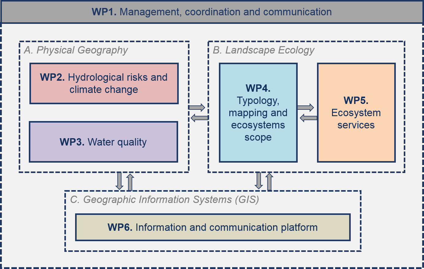
Specific objectives include: 1) Development of a uniform ecosystem database by linking the main ecosystem types, the global classification of ecosystems, and the ecosystem extent accounts; 2) Development of a uniform set of indicators for the assessment of ecosystem condition and water-related ecosystem services with a focus on the regulation of hydrological risks and water quality; 3) Development of mapping and assessment approaches in relation to ecosystem accounting; 4) Integration of the results into a uniform database and development of a web-based tool for data sharing and dissemination.

The project concept is based on the hypothesis that the integration of the appropriate elements of the nine methodologies and their further conceptualization focused on hydrological risks and water quality regulation will allow the development of a flexible methodology based on modern approaches to spatial analysis and modeling. This methodology will provide tools to quantify the implementation of nature-based solutions (NBS) for activities such as flood risk management, erosion, climate change mitigation and adaptation, “urban heat islands” mitigation in the urban areas, etc.
—
Follow and share:
Website: https://inesproject.com
Twitter: @INESprojectBG | https://twitter.com/INESprojectBG
Facebook: @INESprojectBG | https://www.facebook.com/INESprojectBG
